
The Gateway
The transition where the city gives way.
On the corridor's positioning, Leon Springs is the transition: the place where the city gives way, the historic gateway leading from Northwest San Antonio to the edge of the Hill Country. It has held that role since a stagecoach stop stood here in the 1840s, and it still anchors the stretch of I-10 where corridor geography begins to change.
The corridor's anchors frame it on both sides. La Cantera and The Rim sit to the south at the city end; Fair Oaks Ranch and the communities around it sit to the north at the edge of the Hill Country. Leon Springs is the ground between them, where the transition reads in the terrain, the roads, and the history.
Location
On I-10 at the corridor's southern anchor.
About nineteen miles northwest of downtown San Antonio, in northwestern Bexar County, around Boerne Stage Road and Old Fredericksburg Road. The Loop 1604 interchange is the gateway onto I-10 northwest, and the corridor rises from here.
Corridor position
South: La Cantera and The Rim, the city end of the corridor. North: Fair Oaks Ranch and Boerne, the edge of the Hill Country and the Hill Country proper.
Jurisdiction
Partially within San Antonio city limits.
Leon Springs is an unincorporated community in Bexar County that is now partially within San Antonio city limits. It is never accurate to say that all of Leon Springs sits inside or outside the city: city limits status is verified by address, one property at a time.
The distinction matters on this site because a place name is not a jurisdiction. Leon Springs is a historic community name on the map; where a specific home sits relative to city limits, county, and school district is answered by the records for that address.
| County | Bexar County |
| Appraisal district | Bexar Central Appraisal District |
| School district | Northside ISD for the communities covered on this site; assignment is set by property address and must be verified with the serving district. |
| City limits | Now partially within San Antonio city limits; status is verified by address for every property. |
History
A stagecoach stop that became a corridor anchor.
Leon Springs grew out of the German settlement of the Texas Hill Country and the stagecoach era that connected San Antonio to points west. Its history is the reason the place still reads as a gateway: it was the first stop out of the city for travelers heading northwest, and the corridor's modern commute follows an old route.
The original Romano's Macaroni Grill was founded in Leon Springs and closed after flooding in 2002. The Leon Springs Dancehall, opened in the early 1990s, closed and was demolished in 2022. Both belong to the area's story in the past tense only.
- 1846
Settled by German immigrants beginning in the mid-1800s, Leon Springs was the site of a stagecoach stop in 1846. The Aue Stagecoach Inn became the first stop on the stagecoach route between San Antonio and San Diego.
- 1857
A post office opened. By 1885 the town had a steam cotton gin, a general store, two hotels, and about fifty residents.
- WWI
During World War I, Leon Springs was the site of an officers’ training camp.
- WWII
The community grew again during World War II with activity at Camp Stanley and Camp Bullis.
Military Heritage and Present
Camp Bullis and Camp Stanley.
The Leon Springs Military Reservation is made up of Camp Bullis and Camp Stanley. The Army began acquiring ranch land here in 1906 for training ranges used by troops from Fort Sam Houston, and the reservation has shaped the area's open space and character ever since.
Camp Bullis
Covers about 28,000 acres northeast of the I-10 and Loop 1604 intersection and is part of Joint Base San Antonio. It serves as a training area for Army, Air Force, and Marine units and as a field training site for Brooke Army Medical Center medical units.
Camp Stanley
Used for munitions storage and testing, Camp Stanley completes the reservation alongside Camp Bullis.
Local Landmark
Rudy's Country Store and Bar-B-Q began here.
The Rudy's Country Store and Bar-B-Q story began in Leon Springs. Rudolph Aue opened a filling station, repair shop, and grocery here in 1929 and added barbecue in 1989. The original location is the start of what became a regional chain, and it roots the corridor's roadside character in this crossroads.
Daily Life
A crossroads with the corridor on both sides.
Day to day, Leon Springs means the Leon Springs H-E-B and local dining along I-10, with quick access south to La Cantera, The Rim, and Six Flags Fiesta Texas, and north to Fair Oaks Ranch and Boerne. The gateway position that defined its history is also its daily-life convenience: the city end and the outer corridor are both minutes away.
Communities on This Site
In or near this area.
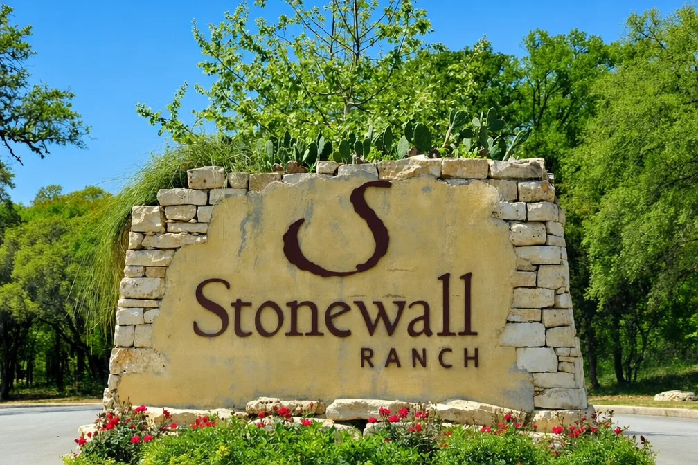
Stonewall Ranch is the corridor community this site profiles in or near Leon Springs. Its profile covers the address story that surprises buyers: a San Antonio mailing address on Bexar County land that already feels like the Hill Country.
Because Leon Springs sits at the boundary between city and county territory, the “Verify Where a Home Is Located” guide is the right next read: it walks through city limits, ETJ, county, and the record checks that answer address-specific questions.
Stonewall Ranch
Read the profile →
Gated Bexar County community on the I-10 frontage road near Cross Mountain, between the Leon Springs interchange and Fair Oaks Ranch.
Advisory
Planning to Buy Along the Corridor?
The corridor rewards buyers who verify before they bid. Tami Price brings two decades of San Antonio area real estate experience to buyer representation along the corridor and can walk you through jurisdiction, school assignment, taxes, and community dynamics before you commit.
Conversion happens at TamiPrice.com · Tami Price Properties